
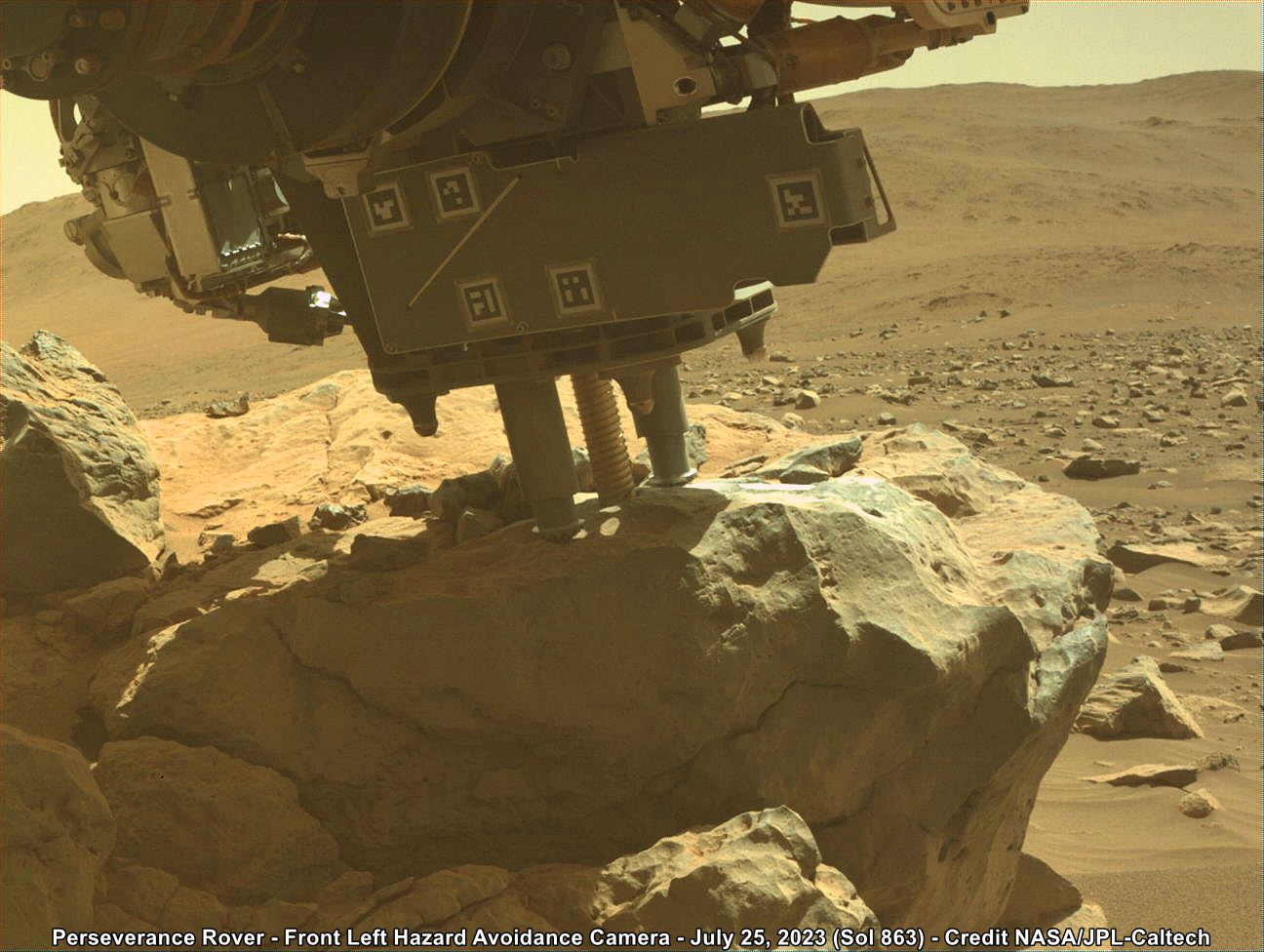
Perseverance has started to core the top of the ‘Mount Meeker’ target, its coring bit is placed a little to the left of the ‘Dragons Egg’ abrasion patch that the rover has been inspecting for several sols. For scale the diameter of the drill bit is ~25mm (1 inch). Processed F-L HazCam image from Sol 862 (July 25, 2023).
Credits: NASA/JPL-Caltech
I’m assuming whomever named these spots on Mars took inspiration from Mt Meeker in Colorado. This also has a rock feature on its southwest slope called the dragons egg.
The feature is prominent in a technical backcountry ski route called The Dragons egg couloir.
They sure did…
Jezero crater has been divided into more than one hundred map quadrangles to aid geological mapping. Each of these square areas of interest spans 0.025 degrees in latitude by 0.025 degrees in longitude, each quadrangle measures about 1.5 kilometers square or about 1.22 x 1.22 km. (0.75 x 0.75 miles)
The map quadrangles in the crater are informally named after Earth based national parks or preserves. The assigned map name will then form the ‘theme’ for naming targets of interest within that map.
The rover is currently in map quadrangle ‘Rocky Mountain’ hence the naming convention / theme :)
@okfuskee @paulhammond5155
Jezero crater has been divided into more than one hundred map quadrangles to aid geological mapping.
The map quadrangles in the crater are informally named after Earth based national parks or preserves. The assigned map name will then form the ‘theme’ for naming targets of interest within that map.
The rover is currently in map quadrangle ‘Rocky Mountain’ hence the naming convention / theme :)
See attached mission map with the quadrangle names
Basically they take a geological region from somewhere here on earth, such as Colorado or The Rocky Mountains, and take names from those regions.